| KM | Highway Point & Features | Elev.
(metres) | Map | Add
Info |
| 0 | Junction Highway #3 with Highway #97 | 340 | | |
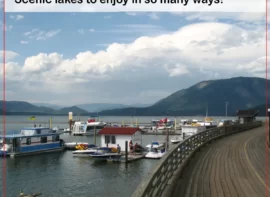
| Osoyoos Visitor Centre to the NE of the junction. Highway 97 north to Osoyoos Desert Centre (3 km N, open seasonally), several wineries, Oliver, Penticton, and Kelowna. Highway 97 south to US border and Oroville, WA | | | |
| 5 | Meadowlands Dr (to S) | 480 | | |
| indicating Richter Pass, with a view of the irrigation giving life to the 45,000 acres in the valley below. Access to Osoyoos | | | |
| 10 | Historical Interest Marker and Lookout on NE side of highway | 599 | | |
| 13 | Spotted Lake (to S of Highway – private property) | 683 | | |
| Spotted Lake Okanagan First Nation | | | |
| 14 | Kobaur Lookout Forest Service Rd | 524 | | |
| Historical marker about Spotted Lake | | | |
| 19 | Richter lake (to SE of highway) | 458 | | |
| 23 | Frank Lake ( to S of Highway) | 464 | | |
| 26 | Nighthawk Rd (to SW) | 374 | | |
| access to US border crossing | | | |
| 29 | Sumac Rd (to W) | 381 | | |
| Forbidden Fruit Winery (2 km S of highway) | | | |
| 31 | Scout Vineyards & Winery | 404 | | |
| 33 | S’milka Vista Vineyards | 398 | | |
| view of the Similkameen River Iron Bridge to W | | | |
| 34 | Chechella Beach | 427 | | |
| 35 | Phantom Creek Estates Winery, Vanessa Vineyard, Seven Stones Winery, | 413 | | |
| 37 | Ntamtqen Snm’na?m’aya?tn First Nation | 403 | | |
| Lower Similkameen First Nation | | | |
| 45 | Twisted Hills Craft Cider, Eauvivre Winery & Vineyards | 404 | | |
| 49 | Becks Rd | 435 | | |
| grocery to NE and Hugging Tree Winery to NE | | | |
| 51 | Junction Highway 3/3A to Penticton | 435 | | |
| Keremeos is on the Similkameen River at the junction of Highway 3 and 3A. Attractions include Keremeos Museum, The Similkameen Pow Wow, The Keremeos Elks Rodeo, Chopaka Rodeo. Accommodation: Riverbank Vineyard and B&B, Orchard View B&B | | | |
| 52 | Ashnola Road | 419 | | |
| access to Sna?snulax?tn Campground (Pow-wow Grounds) 5 km to W. Cathedral Provincial Park 30 km SW of Keremeos. Camping, tenting, picnic area, hiking. Cathedral Park comprises an expanse of jagged mountain peaks, azure lakes and flower-dappled alpine meadows. This park offers limited vehicle accessible campsites. Facilities: Pit or Flush Toilets – Picnic Areas – Campfires – Walk-In/Wilderness Camping. | | | |
| 52 | Eagle RV Park and Campground (S side of highway) | 412 | | |
| full hookups, sani-station, pull throughs ,tenting, all services | | | |
| 53 | 7th Street | 416 | | |
| Highway makes a street corner 90 degree turn in Keremeos | | | |
| 53 | Keremeos Bypass Road (to N) | 425 | | |
| Orchard View (motel) to S and Riverbank Vineyard and B&B to S | | | |
| 54 | view of Red Bridge (Ashoka Bridge) across Similkameen River, | 457 | | |
| on SW side of highway | | | |
| 56 | American Railway Rest Area | 454 | | |
| An American railroad, subsidiary of Great Northern Railway, served the area from 1907-1914 | | | |
| 61 | Wildlife Viewing Pull Out | 467 | | |
| Sometimes there are mountain goats grazing near this pull out. | | | |
| 68 | Riverside RV Park Resort | 495 | | |
| 73 | Rustic Campground | 512 | | |
| 77 | Cluckchuway Indian Reservation | 523 | | |
| 77 | Hedley Nickel Plate Road (North side) | 548 | | |
| Historical marker: $45 million in gold extracted from the Hedley Mascot mine between1908-1955 | | | |
| 77 | River Haven RV Campground | 524 | | |
| and Old Mountain RV Park & Cabins | | | |
| 80 | Daly Ave (North side) | 554 | | |
| Made famous by the discovery of gold in 1897. Attractions – Hedley Museum & Tourist Booth, Hedley mascot and Gold Mine Tours, | | | |
| 83 | Pine View Campground | 547 | | |
| 85 | Stemwinder Provincial Park | 543 | | |
| Camping, Tenting, fishing, wheelchair access. This park offers 27 vehicle accessible campsites, one pull-through site. Facilities: Pit or Flush Toilets, Group Camping, Drinking Water , campfires. | | | |
| 86 | Pickard Creek Recreational Site | 575 | | |
| Camping, tenting, picnicking, fishing, wheelchair access | | | |
| 86 | Old Hedley Road and bridge over Similkameen River | 575 | | |
| cross Similkameen River | | | |
| 88 | Happy Days RV Park | 575 | | |
| 89 | The River House Retreat | 575 | | |
| 92 | Old Outpost Camping | 575 | | |
| 99 | Princeton Wood Preservers (creosoting plant) to SW | 575 | | |
| 100 | roadside turnout on N site | 575 | | |
| view of Similkameen River | | | |
| 101 | Wolf Creek Rd (S side) | 586 | | |
| 106 | Happy Holiday Farm (N side) | 628 | | |
| 110 | Princeton Municipal Campground (on N side) | 625 | | |
| partial hookups, hot/cold water, toilets, showers, sani-station, phone | | | |
| 112 | Taylor Way (on N side) | 628 | | |
| residential area, no services | | | |
| 113 | Princeton Golf Club (on S side) | 638 | | |
| Public Course 9 hole/par36 | | | |
| 116 | Old Copper Mountain Rd | 638 | | |
| access to RCMP, Evergreen (motel) on SW side of highway, Princeton RV Campground on NE side of highway | | | |
| 117 | Junction with Highway 5A north, and into Princeton Business District | 641 | | |
| bridge over Similkameen River | | | |
| 118 | Burton Ave to SE, Vermillion Ave to NW | 702 | | |
| access to central business district | | | |
| 119 | Ridgewood Dr (on NW side) | 837 | | |
| access to Sandman Inn Princeton Deerview Lodge and Cabins, Princeton General Hospital to N of highway | | | |
| 129 | Paradise Ranch | 1132 | | |
| Trail Rides | | | |
| 135 | Rest Area | 1136 | | |
| Rest Area and toilets one side of highway | | | |
| 136 | Kennedy Lake Reserve, and Campsite | 1160 | | |
| Tent/Trailers, fishing, water, washrooms, showers, sani-station | | | |
| 136 | Lakeside Camping & RV Lots | 1287 | | |
| 151 | Sunday Summit | 1133 | | |
| Brake check for trucks | | | |
| 151 | Mine Hill Brake Check | 962 | | |
| Bathrooms at this rest stop. Kenney Lake Reserve (to W) and Copper Mountain( to E) | | | |
| 155 | Copper Creek Recreation Site | 962 | | |
| 158 | Placer Forest Service Road | 1011 | | |
| Copper Creek Recreation Site (to E of highway) | | | |
| 162 | Similkameen Falls Campground | 1035 | | |
| 165 | Garrett Rd | 1035 | | |
| Manning Park Eastgate Lodge (S side) | | | |
| 165 | East Gate: Manning Provincial Park | 1037 | | |
| The east entrance to the park is guarded by a wood carved sculpture of a large black bear. Camping facilities in Manning Provincial Park: Camping. This park offers vehicle accessible campsites. There are four summer drive-in campgrounds with a total of 355 sites with Showers, Pit or Flush Toilets, Picnic Areas, Group Camping, Drinking Water, Campfire, Cabins / Huts / Yurts, Boat Launch, Sani-Station/Dump, Similkameen Chalet (S side) | | | |
| 166 | East Gate Village | 1035 | | |
| A small village where there is gas, food, and other basic amenities. | | | |
| 166 | East Gate Village | 1086 | | |
| Service Station & food | | | |
| 172 | Mule Deer Campground | 1133 | | |
| 49 Vehicle Accessible Campsites | | | |
| 177 | Hampton Campground (to NW) | 1131 | | |
| Bridesville Townsite Rd. East end of Bridesville, BC | | | |
| 179 | Blow Down Rest and Picnic Area (SE side of highway) | 1138 | | |
| Bridesville Townsite Rd. West end of Bridesville, BC | | | |
| 180 | Monument 83Trail Head | 1177 | | |
| Access to RV Park and Bed and Breakfast | | | |
| 180 | ‘Sub Alpine Meadows’ turn off | 1198 | | |
| Explore the sub alpine meadows just 15 km off the highway. In the Spring and early Summer feast your eyes on the abundance of sub-alpine flowers. | | | |
| 182 | Cascade Look Out turnoff | 1194 | | |
| 8km from the highway turn off | | | |
| 182 | Lightning Lake Campground turn off | 1166 | | |
| Turn off to Lightning Lake. Lightning Lake Campground has tent/trailer camping, picnic area, and swimming. Total Number of Vehicle Accessible Campsites: 143. | | | |
| 182 | Beaver Pond Trail head | 1192 | | |
| hiking | | | |
| 182 | Gibson Pass Rd (to S) and Owl Way (to N) | 1180 | | |
| Manning Park Ski Area (8 km SW of highway), Downhill & Cross Country Skiing. Several lakeside campgrounds just to west of highway. | | | |
| 182 | Owl Rd (to N) has Manning Park Visitor Centre | 1179 | | |
| Manning Park Resort has Lodging, Hiking, food, downhill skiing, cross country skiing, | | | |
| 183 | Manning Provincial Park Visitors Centre | 1229 | | |
| Tourist information, toilets, sewage dump. | | | |
| 184 | Coldspring Campground | 1333 | | |
| Tent/Trailer camping, picnic area. (64 Vehicle Accessible Campsites) | | | |
| 186 | Cambie Creek Recreation Area | 1346 | | |
| Cross Country Ski area. Cambie Creek is headwaters for the Similkameen River. | | | |
| 190 | Allison Pass Summit | 798 | | |
| Summit elevation is 1342 metres. | | | |
| 207 | Cayuse Flats Trail Head | 807 | | |
| Hiking | | | |
| 212 | Skagit River Pull Out | 762 | | |
| Highway 3 runs alongside both rivers as it journeys through the park, so keep a lookout for good casting spots. | | | |
| 213 | Cascade Recreation Area parking lot | 706 | | |
| to N of highway | | | |
| 215 | Rhododendron Flats Interpretive Walk | 639 | | |
| A short trail wind through vegetation decidedly coastal. The trail’s principal attraction is the rare and lovely shrub, the Red Rhododendron, which blooms in great profusion in mid June. | | | |
| 215 | Sumallo Grove Interpretive Trail | 625 | | |
| Trail walks and rest area. At Sumalo Grove, the Sumallo River flows into the west-flowing Skagit River | | | |
| 221 | Scenic Pull Out – Sumallo River | 675 | | |
| The Sumallo River flows to SW of highway, with several . Pull-outs, which are popular with flyfishers trying to catch trout (BC fishing licence required) | | | |
| 222 | Engineers Road’ Historical Marker with Pull Out and short hike | 684 | | |
| By a gravel pull out, is the abandoned Dewdney Trail and wagon road built in 1861 to transport miners to the gold rush of Rock Creek. Work ended when attention shifted to the Gold fields of the Cariboo much further north. To the east, Twenty Mile Creek flows on the south side of the highway. | | | |
| 225 | Lakeside Dr (N), Sunshine | 665 | | |
| Cedar Lake to N, SV Skating rink, community of Sunshine Valley Sunshine Valley RV Resort & Cabins to S side of Highway. Sign of Historical Interest: Sunshine Valley Tasme Museum (about WWII Internment camp for 21,000 Japanese-Canadians) to S of highway | | | |
| 225 | Western Entrance of Manning Provincial Park | 684 | | |
| ‘West Gate Portal offers picnicking, day use facilities and hiking. | | | |
| 225 | Sumallo Lodge & Restaurant | 734 | | |
| 604-869-9669 Accommodation, gas, and food. | | | |
| 232 | Roadside Highway Turnout – Hope Slide Rest Area | 659 | | |
| Visit the historic Hope Slide. Two interpretive signs tell of the story of the massive Hope rock slide. The Hope Slide was one of the largest landslides ever recorded in Canada. | | | |
| 234 | Old Hope-Princeton Highway junction (to NE) | 345 | | |
| 239 | Berkey Creek, BC | 261 | | |
| 242 | Nicolum River Provincial Park | 129 | | |
| This is a very small park with only nine campsites, so it fills quite quickly. There is a small day-use/picnicking area with picnic tables and parking area. Fishing. | | | |
| 243 | Hope, BC Exit #177 | 257 | | |
| 243 | Junction with Coquihalla Highway #5 | 106 | | |
| North to Merritt and Kamloops | | | |
| 248 | Hope, BC Exit #173 | 107 | | |
| gravel turnoff right before WB exit | | | |
| 249 | Sunshine Valley Hamlet | 59 | | |
| 250 | Junction Highway 3 and Highway #1 along riverfront of Hope, BC. | 599 | | |
| Hope has many services for gas, food, and accommodation. Attractions: Hope Museum ,Hope Slide, Othello Tunnels located in the Coquihalla Canyon Provincial Park | | | |
| KM | Highway Point & Features | Elev.
(metres) | Map | Add
Info |


")