


Geology of the Canadian Shield and Glaciers

The Niagara Escarpment is the reason the Falls of Niagara was born. Today’s 1,609 kilometer (1000 mile) long Niagara Escarpment begins in Watertown New York, USA and continues north to Lake Huron and then westerly along the Manitoulin Island in Ontario, Canada, and then bends through Wisconsin and Illinios. The section between Hamilton, Ontario and Watertown, New York the escarpment ranges from 183 meters (600 feet) above sea level to 189 meters (620 feet) above sea level.
The Niagara Escarpment was created long before Ice Age glaciers. The land that is now Southern Ontario was the bottom of an ancient tropical salt water sea, as evidenced by ancient fossils in the area’s rocks dating back to 430 – 415 million years ago. The area emerged from the sea in the Paleozoic Era about 245 million years ago. It was much later, approximately 65 million years ago (between the Cretaceous and the Tertiary periods), scientists believe a giant asteroid collided with the Earth near Mexico’s Yucatan Peninsula, leading to the extinction of the dinosaurs.
There were three distinct Ice Ages Over the past 65,000 years, with a huge glacier stretching south from Hudson Bay, known as “the Wisconsin Glacier”. During those times, the Niagara Escarpment was covered with a sheet of ice 2 – 3 kilometers thick. The last Ice Age lasted approximately 8,000 years before retreating 12,000 years ago. As the Glacier retreated, the water levels slowly lowered forming four lakes:
- Glacial Lake Algonquin – ( area including Lake Superior, Lake Michigan and Lake Huron) which drained east via Lake Nippissing to the Niagara Falls Valley, and also south toward Lake Ontario
- Glacial Lake Warren – small (Lake Erie)
- Glacial Lake Iroquois – small (Lake Ontario) which drained via the Mohawk/Hudson valleys
- Glacial Lake Tonawanda – area western New York
As the glacier retreated, the land pushed up (“isostatic rebound,” without the weight of solid ice upon it) cutting off these outlets with the exception of the Niagara River. At that time, the glacier still blocked the St Lawrence, so water over the Niagara drained to the ocean via the Mohawk and Hudson River Valley. Later, as the land in this area rose, the route to the ocean shifted east to the Champlain Valley, dropping the water level in Lake Iroquois dropped 15 meters (50 feet).

When the Wisconsin Glacier had retreated north of the St. Lawrence Valley, allowing water to drain east, Lake Iroquois’s water level dropped close to sea level. Over the past ten thousand years, the land around Lake Ontario continued its post glacial rebound uplift, bring its elevation to current levels. During the past 100 years alone, continued glacial rebound at the eastern end of Lake Ontario has lifted the water level at the western end of the lake by 0.3 meters (1 foot).
Twelve thousand years ago, the Niagara River became the main water outlet for much larger Lake Erie to flow over the escarpment into a larger Lake Iroquois (Lake Ontario). At that time, the lake plain of Lake Iroquois (Lake Ontario) was within 11 meters (35 feet) of today’s level of the Niagara Escarpment at Queenston, Ontario. The height of the initial Niagara Falls was only 11 meters (35 feet) at Queenston falling right into Lake Iroquois below. Over time, the water chewed through the glacial material and the limestone rock of the Niagara Escarpment to form today’s Niagara Gorge.
Eleven thousand (11,000) years ago, the land rose enough that the entire flow of the Upper Great Lakes flowed into the Lake Erie basin through the Niagara River. The Niagara River today drains an area of 254,708 square miles (409,901.5 square kilometers) including the Upper Great Lakes.
Four thousand – five hundred (4,500) years ago, the crest line of the Falls was located north of the current Whirlpool Bridge. Two thousand (2,000) years ago, the crest line of the Falls was located north of the current Rainbow Bridge. Niagara Falls has eroded 11.4 kilometers (7.1 miles) during the last 12,300 years The mean rate of erosion was 3.5 meters (5 feet) per year. Since 1942 the rate has been much slower (about a1 foot per decade), attributed to water going through the hydro power generators instead of over the Falls.
Indians & Early Exploration

The first humans, the Clovis people, arrived in Niagara Region almost 12,000 years ago, around the time of the birth of the Falls, when the land was tundra with spruce forests. These nomadic hunters camped along the old Lake Erie shoreline, in small dwellings, and left little behind except chipped stones, likely used to hunt caribou, mastodons, moose and elk.
By 9,500 years ago deciduous forest covered southernmost Ontario, supporting wildlife like deer, moose, fish and plants, enabling small groups to hunt in the winter, coming together into larger groups during the summer, to fish at shorelines and at the mouths of rivers.
About 2,000 years ago, the Woodland Period brought Iroquois culture in southern Ontario. These peoples began agriculture based on crops of corn, bean and squash, which supported a boom in population and a rich culture with small palisaded villages in which extended families occupied individual longhouses. They developed ceramics technology and forged strong inter-village alliances.
By the time the European explorers and missionaries arrived in the early 1600s, the Iroquoian villages had elected chiefs and were allied within powerful tribal confederacies. The Neutral Indians were the leaders of a group of ten tribes of the Iroquois Nation. Other tribes included the Seneca, Mohawk, Oneida, Onondaga, Cayuga, Huron, Petun, Erie and the Susquehannock. The French explorers , gave this Indian tribe the name “Neutrals”, because of their position and status as peace keepers between the warring Hurons and Iroquois. Unfortunately, inter-tribal warfare was made worse by the intrusion of the Europeans.
In May 1535, Jacques Cartier left France to explore the New World, and was told by the Indians he met along the St.Lawrence River about Niagara Falls. When Samuel de Champlain visited Canada in 1608, he too heard the stories, but it was Etienne Brule, who in 1615 was the first European to see the Falls as well as explore Lakes Ontario, Erie Huron and Superior. He was followed shortly by the Recollet missionary explorers, and a decade later by the Jesuits. It was a Jesuit father, Gabriel Lalemant, who first recorded the Iroquios name for the river- Onguiaahra, meaning “the Strait”. “Niagara” is a simplification of the original.
In 1641 the Onguiaahra Indians (also called the “Neutral” Indians) were the predominant tribe along the Niagara River. The French initiated a fur- trade rivalry between the Huron and Iroquois, which turned into a 6 year long Indian war which pushed the Huron Nation to the north and scattered them throughout Ontario. The Iroquois moved into the Niagara area, pushing the Neutral Indians eastward to the area of Albany, New York. The wars also managing to keep Europeans settlers away until after the American Revolution.
On December 7th 1678, Jesuit Priest Father Louis Hennepin, and the great explorer La Salle established an outpost at the mouth of the Chippawa Creek at the Niagara River. The next day they saw the Falls and Father Louis Hennepin made a sketch of it, published in a 1699 book entitled “New Discovery” (first French edition 1697). He estimated their height to be 183 metres, more than three times what it really is.
British Settlement in Niagara
Over the next one hundred years, the French expanded west along the Great Lakes from Montreal, and the British expanded westward overland from their 13 colonies and southward from their trading posts on the shores of Hudson’s Bay. Their European rivalry and occasional wars precipitated actions in the New World.

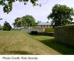
In 1759, the British attacked the French at Fort Niagara, who after 19 days, surrendered and withdrew, destroying their “Magazin Royal” and development at the lower landing at Lewiston. The British immediately took over the portage and graded the road so supply wagons could be pulled up the escarpment. They also replaced the workforce of French-favoured Seneca Indians, increasing hostilities in the area, forcing them to build Fort Demler at Lewiston as an auxiliary outpost between Fort Niagara and Fort Schlosser at Niagara Falls for safe refuge. By 1763, a treaty with the French gave Britain all the colonies along the North American east coast. In September 1763, a British wagon train was attacked (along with 80 soldiers sent to help them) by 500 Seneca Indians along the top of the Niagara Gorge above the Devils Hole Cave. This Indian attack became known as “the Massacre at Devils Hole”. Two months later, the Seneca unsuccessfully attacked Fort Demler and launched the “Pontiac Rebellion”.
In 1759, Daniel Joncairs was the first person to have harnessed the gravitational power of Niagara, digging a narrow ditch above the falls on the American side to draw enough water to turn a waterwheel to power his small sawmill.
By 1764, Lewiston had a series of military redoubts (a polygonal out-building providing flanking defenses) along the length of the portage. Captain John Montresor, a British engineer, strengthened the British fortifications with eleven two-storey log blockhouses strategically located along the length of the Portage Trail. The British also built the first elevator built in North America to move boats, supplies and arms to the top of the escarpment, with two wooden cradles on a pair of counterbalanced tramways inked by rope over a pulley at the top (when one went down, the other went up). This tramway, which could carry 14 barrels at a time, ran till 1810. The British also built a fort at Lake Erie and the Niagara River, called “Fort Erie”.
By 1775, the Battle of Lexington began the American Revolution. Divided loyalties tore apart the Iroquois Nation, with Iroquois tribes supporting the British, and the Tuscarora and Oneida Indians supporting the Americans. By 1778, the British and their supporters retreated to the west bank of the Niagara, around Fort Niagara, with American settlements growing along the East bank.
The British were reluctant to settle along the West side of the Niagara River because a 1763 treaty gave those lands to the Indians. In 1781, Colonel John Butler purchased a 100 acre tract of land near Queenston from the Mississauga Indians. The first settlers on this land were the Secords, the Dolsons, the Showers and the Lute families, joined a year later by another eleven families.
The early settlers used a portage trail that led from Isaac Dolson’s property located in Queenston below the Niagara Escarpment. and wound its way up to the top of the escarpment to Chippawa, now known as the Portage Road. By 1788, Ox drawn carts with supplies became a regular site along the Portage Road, which would become a vital transportation link during the War of 1812.
Prior to 1788, the Western New York area was Indian country, except for the French outpost at Fort Little Niagara (approximately one mile above the Falls, opposite Chippawa), and the British outpost at Fort Niagara. Fort Little Niagara was destroyed in 1759 after the French surrender to the British, who replaced it with a small British stockade, which was later rebuilt by American soldiers and named Fort Schlosser.
The roadway between Niagara-on-the-Lake and Chippawa was the first designated King’s Highway, with Upper Canada’s first stage coach operating on this road from the late 1700s to 1896.
Eventually Indians signed treaties ceding their Niagara territory of Western New York. Augustus Porter, a surveyor, was the first person to purchase and settle upon the land along the American side of the Falls once the British occupation ended. In 1805, the State of New York offered lands along the American shoreline of the Niagara River for sale. John Stedman used Goat Island to establish a herd of goats, for which practice it is now named. More settlers moved into the area at Lewiston, Niagara Falls and Black Rock (Buffalo). In 1810, Niagara Falls, New York consisted of twelve dwelling houses, a gristmill, a saw mill, a tannery, a tavern, a post office and a rope walk measuring 360 feet long.
The War of 1812
In 1812, United States President James Madison declared war on Canada. Major General Isaac Brock received word that war had been declared while entertaining American officers at Fort George in Newark (Niagara on the Lake). Brock announced the declaration of war to his guests, and said his goodbyes to the Americans guests.
The Americans had 6,000 soldiers along the Niagara Frontier under General Stephen Van Rensselaer while the British had 1,200 regular soldiers bolstered by various militias. The Americans attacked Fort Niagara (at Youngstown, New York) forcing the British to abandon the fort and move to Fort George along the western banks of the Niagara River.

On October 13th 1812 the Americans invaded Upper Canada at Queenston under cover of morning darkness, but were spotted by a lone sentry, who notified the British soldiers at Queenston Heights. The American Commander Colonel Solomon Van Rensselaer was hit by six musket balls and killed. The American artillery batteries in Lewiston, New York began to bombard British troop positions in Queenston.
At Fort George, Major General Brock could hear the sounds of battle and quickly rode to Queenston, leaving orders for the main British garrison to march to Queenston at first light. At Queenston, Major General Isaac Brock saw a massive invasion force of Americans ready to be ferried from the American shoreline at Lewiston, and called for more British troop reinforcements from Fort George and Chippawa.
Major General Brock wanted to hold the high ground at Queenston Heights, but was in the middle of the battle after American infantry under Captain John Wood snuck up the escarpment to near the top of Queenston Heights. He began to counter attack the Americans with the 200 soldiers he had, before either British or more American reinforcements could arrive, but the attack was stalled by American artillery fire. During a charge in an attempt to retake the Redan Battery at Queenston Heights, Major General Isaac Brock was shot in the chest by an American marksman, and fell to the ground mortally wounded. When two companies of British militia from York arrived under aide de camp, John Macdonell, they attacked unsuccessfully, killing Macdonnell. Victory at the battle of Queenston Heights was clearly won by the Americans.
The New York State militia was watching the battle from the American shore, and saw the dead and injured Americans ferried back across the river. When they were to be ferried across to join their regular American army counterparts on the Canadian side of the river, they refused to go which under their constitution they had the right to do. This denied the regular American troops reinforcements to help fortify their newly won ground.
Major General Sheaffe, who replaced Brock, waited for reinforcements and along with some Indian allies of the British attacked and out-flanked the Americans, forcing the American commander, Winfield Scott to surrender to the British.
Brigadier General Smyth replaced the disgraced General Van Rensselaer and proclaimed publicly that he would invade Upper Canada before the end of the month. On November 17th 1812, in order to stop an American invasion, the British bombarded Smyth’s headquarters and on November 21st 1812, bombarded Fort Niagara. The Americans responded with an artillery barrage of their own striking at Fort George.
On November 28th 1812, 400 American soldiers invaded Upper Canada by crossing the Niagara River between Black Creek (Buffalo) and Fort Erie. While one group seized the gun batteries between Fort Erie and Frenchman’s Creek, the second group destroyed the Frenchman’s Creek bridge in order to slow the arrival of reinforcements from Chippawa. The British army quickly foiled this American incursion, forcing the Americans to retreat back to Black Creek.
During the winter of 1812 – 1813, there was little war activity in Niagara, and the time was used by both sides to re-supply and reinforce their armies. The war between the Americans and the British continued in Kingston and along the St. Lawrence River including a successful British attack on the Americans at Ogdensburg, New York in February, 1813. In April, 1813, the Americans retaliated with an attack on Fort York (Toronto) forcing the British to abandon the fort after they set it and all their ships & supplies on fire. The Americans finally left York in May but burned the Parliament Buildings to the ground on their way home.
In June 1813, American Lieutenant Colonel Charles Boerstler of the American 14th infantry was ordered to march to Beaverdams to attack the British troops there. On their way, three American officers stopped at the house of Laura Secord in Queenston and forced Secord to prepare and serve dinner to them. During their meal, the officers discussed their impending attack, not thinking that Laura Secord was listening. After the Americans had left the house, Laura Secord delivered warning of the attack to the British commander.

Lieutenant Colonel Boerstler set out for Queenston with 700 soldiers. Iroquois Indian leader Dominique Ducharme picked out an ambush site along the American’s route and placed Caughnawaga warriors on one side and Six Nations warriors on the other, leaving many Americans dead and injured, but still outnumbering the British. Only after the British received reinforcements and his forces were surrounded did Boerstler surrender. This battle was a victory for the Indians fighting alongside the British, and made Laura Secord a legend.
In September 1814, the Americans defeated the British in the greatest sea battle of the war on the River Thames, which damaged the British naval capability and allowed the Americans to rule the waterways. The American navy now controlled the waters of the Niagara River.
In December 1813, The Americans abandoned Fort George, returning to Fort Niagara, and torched the settlement of Newark (but leaving Fort George standing). The British reinforced the fort and built a new for across from Fort Niagara, called “Fort Mississauga”. A few days later, the British attacked the Americans at Fort Niagara with fighting at close quarters with bayonets, defeating them and then burned Lewiston, Manchester (Niagara Falls, New York) and Fort Schlosser. The British marched southward and burned the settlement at Black Creek and Buffalo.
The winter of 1813-1814, was quiet, with the Niagara area in ruins and both sides re-supplying and reinforcing. In the spring of 1814, the British had defeated Napoleon in Europe, freeing British troops to be deployed against the Americans.
The American commander Major General Jacob Jennings Brown planned to feign an attack on Niagara while actually attacking Kingston instead. While he massed troops in Buffalo, the British had 2,700 soldiers in the Niagara Peninsula along with their Indian allies from the Niagara Falls, Chippewa, Delaware, Munsey, Wyandos, Fox, Shawnee, Moravian, Cherokee, Kickapoo and the Sioux tribes.
In July 1814 the Americans invaded Upper Canada by crossing the Niagara River landing north of Fort Erie under a hail of gun fire. The 6,000 American soldiers captured 137 British and marched northward towards Chippawa. The 30 minute battle of Chippawa ended with 1,300 American regulars defeating 1,500 British soldiers. The Americans forced the British to retreat under heavy gunfire to Chippawa Creek (Welland River) and crossing it before destroying the wooden bridge. This would be the first battle where the American regular forces defeated the British regular forces. After three days of shadowing the British forces across the river, Major General Brown withdrew his forces back to Chippawa in order to re-supply his army.

Major General Brown’s next attack would be on Burlington Heights, which he reasoned if captured would cut off Fort George and Fort Niagara from men and supplies.
On July 25th 1814, Major General Phineus Riall marched his British army southward towards Chippawa from Queenston, arriving at Lundy’s Lane Hill at noon providing a vantage point over the surrounding countryside. That afternoon, American commander Major General Brown was convinced that the British were invading Lewiston and sent General Winfield Scott with a brigade towards Queenston to force the British to withdraw.
Scott’s brigade was spotted by a British sentry, who notified the main British force. General Scott and his American infantry proceeded cautiously, having been given overstated number of British strength by a tavern owner. As the Americans approached Lundy’s Lane, British Major General Riall first retreated but ran into British Major General Gordon Drummond with reinforcement troops a mile north and quickly returned back to Lundy’s Lane Hill.
As Scott and his infantry brigade advanced, the British opened fire. Scott quickly realized that he was facing the bulk of the British forces, however that he still outnumbered the British. The battle of Lundy’s Lane continued into the night, with the British abandoning Lundy’s Lane Hill following unsuccessful counterattacks. About midnight, as the British were facing certain defeat, the Americans were ordered by Scott to withdraw back to Chippawa to resupply water, allowing Lundy’s Lane Hill to be retaken by the British. When the Americans returned in the morning, they found that the British had reinforced and entrenched themselves. In the end, 5,000 American soldiers faced 2,200 British soldiers, militia and Indians in the largest and bloodiest battle of the war, but the Americans withdrew to Fort Erie, having sustained 1000 casualties (the British had almost 900, including General Riall taken prisoner).
The last battle in the War of 1812 in the Niagara area was the Battle of Cooks Mills, when 2000 American soldiers attempted to attack the British in Chippawa from the unguarded west. They ran into 750 British soldiers under the command of General Riall, who forced the Americans to retreat back to Fort Erie. In March 1815, a treaty ended the war. The war improved nationalism on both sides of the border.
Both American and British borders would remain heavily guarded by military troops until the 1870’s, though the forts at Fort George and Fort Chippawa were abandoned. The borders between the two countries remained the same as they had before the war began, as was established by the Jay’s Treaty of 1794. Lundy’s Lane also became a popular tourist spot.
1837 Rebellion
William Lyon Mackenzie, a Scottish native, was a journalist who became the first Mayor of Toronto and a member of the House of Assembly for York County. He was a leading critic of the ruling oligarchic elite of Upper Canada, and in December of 1837 led a small insurrection against the British at York (Toronto). Following his unsuccessful coup d’ état, he (with a bounty of £1000 for his capture) and 300 rebel supporters fled to Grand Island, NY and then to Navy Island, and declared it to be the “New Republic of Canada”.
Navy Island is Canadian territory as specified in the Treaty of the Ghent, and is the only Canadian Island in the Niagara River. Growing concern over Mackenzie & his rebels on Navy Island, caused the Government of Upper Canada to send militia to bombard Navy Island, with little effect. On January 14th 1838, MacKenzie and his supporters moved to Grand Island again. Both sides continued to bombard each other which threatened to escalate into war with the Americans.
To cut off Mackenzie’s line of communication and supply, British troops invaded Fort Schlosser, setting fire to the steamboat “Caroline” and setting her adrift, plunging her over the Falls. The British agreed to pay the Americans for any damage, and General Winfield Scott ordered American troops aboard the steamer “Barcelona” to remove MacKenzie and his supporters from Grand Island and transported to Black Rock (Buffalo) as three armed British Schooners watched. Mackenzie was later arrested by U.S. officials for breach of the Neutrality Act.
Railroads, Industrialization & the Tourism Boom
The region began the slow process of rebuilding, turning Queenston into a bustling community, and Chippawa into the centre of distilleries and factories. By 1820, tourists began returning to the Falls of Niagara. A number of hotels were built in the coming decade at the present site of Queen Victoria Park opposite the Table Rock, and in 1833 the first Clifton House was built.
In 1815, the Seneca Indians sold their rights to Grand Island to the State of New York for $11,000. Buckhorn Island and Beaver Island were subsequently sold to the State of New York for $1000 in cash and $500 per year. By 1818 an Iron bridge connected Goat Island and Bath Island, opening them up for industrial uses. By 1824, Grand Niagara (soon to become the Village of Manchester) had become known as a mill town.

In the 1820’s, a stairway was built down the bank at Table Rock and the first ferry service across the lower River began. By 1827, a paved road was built from the ferry landing to the top of the bank on the Canadian side, making this a prime location for hotel development and the Clifton was built there, for which the Clifton Hill is named.
Between the late 1700s and the middle 1800s, boats were the main way to get to Niagara Falls, and by 1896, three boats plied the route between Toronto and Queenston. The first Welland Canal was completed in 1829, connecting Lake Ontario with Lake Erie.
Throughout the 1830’s and 1840’s, Manchester (NY) was a tourist hamlet with 20,000 visitors a year by 1838. The 1840’s heralded the arrival of two daily steam powered trains between Niagara Falls and Buffalo. By 1841, a trip from New York City to Niagara Falls took only forty-eight hours, with a train speeding along at 16 miles per hour (shaving several weeks off the trip). By 1850, 80,000 people were visiting Niagara Falls annually and the population of Manchester grew to just under 3,000 people.
The first railroad in Upper Canada opened in 1841 with horse-drawn carriages running between Chippawa and Queenston. In 1854 it was converted to steam and relocated to serve what was to become the Town of Niagara Falls.
In 1855, the Government of Upper Canada took over all the properties along “the front” In1856, the Village of Elgin & the Village of Clifton were amalgamated and became known as the “Town of Clifton”. In 1881, Parliament of Canada changed the name of the Town of Clifton to “Town of Niagara Falls”. In 1882, Drummondville became the “Village of Niagara Falls”. And in 1904, the Town of Niagara Falls and the Village of Niagara Falls were amalgamated to form the “City of Niagara Falls”

In 1853, the Niagara Falls Hydraulic Power & Manufacturing Company was chartered to use its water build an hydraulic canal, 35 feet (11m) wide and 8 feet (2.4m) deep to transport water from the Niagara River above the Falls to mill sites below the Falls. The canal construction was completed in 1861, and in 1875, the first wheels began turning in the new powerhouse. By 1881, the power company had built a small generating station to provide electricity for the village of Niagara Falls and to power several of the mills. This power plant quickly became a tourist attraction
In 1855, John August Roebling, the designer of the Brooklyn Bridge, built the Niagara Railway Suspension Bridge, the first bridge of its type in the world.
In 1859, the area of Prospect Point Park was known as White’s Pleasure Grounds. This was the starting point of Blondin’s first wire walk across the Falls, and attracted 863,000 visitors in its 8 years under private ownership. In 1885, the State of New York created the New York State Niagara Reservation Park and acquired Prospect Park.
The 1900s

In 1886, Thomas Evershed, a New York State engineer submitted a plan for the generation of 200,000 horsepower at Niagara Falls. The electricity could not be transmitted (using direct current ) to the nearest population center in Buffalo, New York, using the technology of the day. The Niagara Falls Power Company offered a $100,000 prize for anyone who could develop a method to transmit electricity long distance. The prize was won by Nicola Tesla, a Croatian immigrant, who created an effective alternating current (AC) transmission system which was commercialized by George Westinghouse.
In 1883, Westinghouse created an illumination system for Niagara Falls using AC current. One of the first electrified street car services was provided in Niagara, and by 1893 the Queenston/Chippawa Railway carried boat passengers from Queenston to Table Rock and beyond. In 1895, the Niagara Falls Power Company contracted the Westinghouse Company for long distance electric transmission development and implementation, including transformers that could handle 1,250 horsepower and overhead wires that can transmit 11,000 volts. On November 15th 1896, the City of Buffalo joined the power grid being generated from Niagara Falls.
In 1885, the Ontario Government legislated that all the land along the shore of the Niagara River between Lake Erie and Lake Ontario be designated as parkland. This delayed hydro-electric development on the Canadian shoreline but soon the Niagara Parks Commission was seeking ways to generate cash flow. The first electricity generated in Queen Victoria Park was at the Niagara Falls & River Railway Power House. The powerhouse was built in 1892 just above the Horseshoe Falls and provided direct electrical current (DC) for the railway, and worked fine until the Railway ceased operations in 1932.

In 1902, a railway was constructed across the Queenston Suspension Bridge. Later it was extended along the lower Gorge on the American side of the River, connecting back into Canada at the Upper Arch Bridge. This transit line, the Great Gorge Route, continued in service until the Depression. The use of boats declined as tourists increasingly chose to visit Niagara by automobile, bus or train.
The Canadian Niagara Power Company (an American based company financed by the Rothschilds, J. P. Morgan, and John Jacob Astor IV) was incorporated in 1892 and built a hydro-electric generating plant about 500 yards above the Horseshoe Falls on the Canadian site, and started generating electricity in 1905.
The Ontario Power Company (which became Ontario Hydro) also built hydro-electric generating plant at the base of the Horseshoe Falls just above river level, and began generating electricity in 1905. The fifteen generators produced 203,000 horsepower (132,500 kilowatts) of 25 cycle electric power. Water enters this generating station from an inlet located one mile upstream of the Falls near Dufferin Islands. (In 1999, the Ontario Power Generation Company, the successor of Ontario Hydro, decommissioned the Ontario Power Station from service to accommodate construction of Casino Niagara on the former transformer building site).
By 1901, Niagara Falls had become one of the greatest industrial/manufacturing centers in the entire US.
Hotel construction boomed in the early 1900’s and by 1914, more than one million people per year were visitors to the Falls of Niagara.. In 1912, Niagara Falls, New York had a population of 35,000 people. After World War 1, automobile touring became popular. As a response, attractions and accommodations sprang up in strip developments, much of which still survives.

In 1902, the Ontario Hydro Commission was formed and during the Ontario Provincial election of 1905, Adam Beck led the Provincial Conservative Party on an election platform of “water power of Niagara should be free”. Ontario Hydro became the worlds first publicly owned power authority. While initially it resold others’ power, by 1908 it was generating its own power. It began building a new power plant to maximize the total energy from the drop in the Niagara River, by creating a 320 feet (97m) high drop at Queenston, which provides 3 times the power of all the other private generating plants. The water is drawn from the upper Niagara River at Chippawa, and diverted around the Falls via the Welland River and a canal along the top of the gorge. This generating station began producing in 1922 and the ten generators of Sir Adam Beck #1 Power Station produce 403,900 kilowatts of electricity.
Prohibition ended in Canada in 1926. Prohibition ended in USA in 1932. For six years, liquor smuggling became an enterprising yet illegal business.
In 1952 construction began on the Sir Adam Beck Niagara Generating Station #2, which would draw 3 times the water as Adam Beck #1. In 1954, the 16 generators began generating 1,223,600 kilowatts, making it (briefly) the worlds largest. In 1956, there was a catastrophic collapse that destroyed 2/3 of New York’s Schoellkopf Power Station. By 1961, the the New York State Power Authority completed the $800 million Robert Moses Niagara Generating Station who’s 13 turbines have the capacity of 2.4 million kilowatts.
In addition to building this power station, the New York State Power Authority built an eighteen (18) mile (29 kms) scenic parkway with an interchange to the Queenston – Lewiston Bridge, and developed the Whirlpool State Park and Devil’s Hole State Park along the parkway.
Between 1849 and 1962, thirteen bridges were constructed across the Niagara River Gorge. Four of them remain.
Bonus Topic: The Maid of The Mist

The most famous legend in Niagara Falls is that of the Maid of the Mist, the Thunder God Hinum which explained the origin of the Falls of Niagara. This legend originated with the Neuter Indian Nation, which occupied the Niagara District when the first French Christian missionaries arrived.
Long ago, Indian tribes were dying of an unknown cause. Each year the Indians tried appeasing the God Hinu, who with his two sons lived behind the Falls, by sending canoes filled with fruit over the Falls When the Indian’s health still did not improve, they thought that their God was not satisfied. Subsequently, each year they began sacrificing their most beautiful Indian maiden, but still their luck did not improve.
One year, Lelawalo, the daughter of the Chief of the tribe was sacrificed to the spirit of the Falls in a canoe filled with food. As she fell over the mighty cataract, the legend says that this Indian maiden was caught in the arms of the God’s sons. Recalling that she had been sent to her death, the Indian maiden agreed to take one of the sons as her husband, with one condition.
One of the sons told her that there was a poisonous snake living at the bottom of the river, which would get hungry once a year. It would crawl to the where the Indians were and poison their water, which the Indians would drink and then die. Then the snake would return to consume their bodies.
The Indian maiden convinced the youngest son of the God to allow her to return to the tribe one last time to tell them about the snake and how to kill it with spears. The indian braves waited for the snake to return, and speared it. The snake crawled to the edge of the Falls, and died with its body arc-ed like a horseshoe, giving the Falls its shape.To this day, the Gods continue to protect the Indians from evil spirits.
The Maid of the Mist boat, the eleventh boat of that name (though it is numbered, VII the seventh) since the first in 1833, was delivered to the Falls in 1997 in 14 sections built at Cartier Construction in Belleville, Ontario. The Maid of the Mist was assembled and welded together on location, and is 80 feet long, weighs 145 tons and can carry 582 passengers. Interestingly, there is a 6 feet (2m) difference in water level at the Maid of the Mist docks between daytime and nighttime, due to water diversion for power generation..