| KM | Highway Point & Features | Elev.
(metres) |
| 0 | Exit 617 Division Street (S) & Perth Road / Frontenac Road 10 (N), N to towns of Westport (50 km) and Perth (80 km). S to Downtown Kingston (4 km), shopping, gas, accommodation, and hospital. (Kingston) | 94.2 |
| 2 | Exit 615 Sir John A. Macdonald Road.. S to Kingston’s Princess Street (3 km), shopping, Queens University (7 km), St Lawrence College, Lake Ontario Amusement Park. (Kingston) | 88.7 |
| 2.7 | crossing Little Cataraqui Creek, Little Cataraqui Recreation Area N of hwy (Kingston) | 86.6 |
| 4 | Exit 613 Highway 9 /Sydenham Road, Sto shopping, accommodation and OPP. (Kingston) | 105.5 |
| 6 | Exit 611 Highway 38 / Gardiners Road, N to Sharbot Lake (67 km), S to gas, services, accommodation, Catarqui Town Centre shopping, OPP (3 km), Kingston Airport (10 km)… (Kingston) | 110.3 |
| 8 | Westbrook Rd underpass (no access), S to golf course, N to gravel pit (Kingston) | 116.7 |
| 13 | Service Station & restaurant (Eastbound) (Kingston) | 119.8 |
| 18 | Exit 599 Lennox & Addington Road 6, N to Mud Lake Rd to Mud Lake (3 km), S to Parrot’s Ba Conservation Area (10 km) | 124.1 |
| 19 | Old Wilton Rd underpass (no access) | 125.9 |
| 24 | Exit 593 Lennox & Addington Road 4 (Camdem East Road / Highway 133 South), S to Millhaven (10 km), ferry to Amherst Island | 108.8 |
| 26 | Service Station & restaurant (Westbound) (Napanee) | 122.2 |
| 31.3 | Switzerville Rd underpass (no access) (Napanee) | 121.9 |
| 35 | Exit 582 Lennox & Addington Road 5 (Palace Rd) St to Napanee (Napanee) | 95.4 |
| 35.7 | crossing Napanee River (Napanee) | 86.6 |
| 36.5 | Industrial Blvd (S) / Newburgh Rd (N) underpass (no access) (Napanee) | 92 |
| 38 | Exit 579 Lennox & Addington Road 41 (Centre St N), S to Napanee (2 km), shopping, OPP (Napanee) | 94.8 |
| 47 | Exit 570 Desoronto Road (Lennox & Addington Road 10), S to Deseronto (6 km), Picton (27 km) (Napanee) | 108.8 nbsp; |
| 51 | Exit 566 Kings’ Highway 49 / Shannonville Rd (N), Marysville Road (S), S to Tyendinaga Mohawk Territory (3 km) | 102.7 |
| 54.4 | Wyman’s Rd underpass (no access) | 103.6 |
| 54.8 | Salmon River crossing | 91.7 |
| 60 | Aikin Rd underpass (no access) (Trenton) | 104.5 |
| 61 | Exit 556 County Highway 7 (Shannonville Road), S to community of Shannonville (3 km) | 106.7 |
| 64.6 | Mitchell Rd underpass (no access) | 113.1 |
| 73 | Exit 544 King’s Highway 37 / 6 (Cannifton Rd), S to accommodation, downtown City of Belleville, Belleville Harbour (Belleville) | 93.6 |
| 74 | Exit 543 Highway 62, S to Quinte Mall, movie theatre, accommodation, downtown City of Belleville, Belleville Harbour, access to County of Prince Edward (6 km) and Sandbanks Provincial Park (33 km)… (Trenton) | 95.4 |
| Place Victoria Place Bed & Breakfast, 3 km S of highway |
| 74 | Crossing the Moira River, flows into Bay of Quinte (Belleville) | 93 |
| 75 | Sidney St (Hwy 30 / 33) underpass (no access) (Trenton) | 95.1 |
| 77 | Hillaire Rd underpass (no access) (Trenton) | 107.3 |
| 79 | Exit 538 Highway #1 (Walbridge – Loyalist Road). S to Quinte Conservation Area (3 km) & Loyalist College (3 km), golfing, N to gas (Trenton) | 104.5 |
| 80 | Exit 526 Hwy 4 (Glen Miller Rd) S to Trenton, gas, services, accommodation, and CFB Trenton (4 km) (Trenton) | 92.7 |
| 81 | Crossing Trent River / Trent-Severn Canal (Trenton) | 79.9 |
| 83 | Exit 525 Hwy #33 (Trenton-Frankford Rd) S to gas, services, accommodation, and Trenton Memorial Hospital. Access to Quinte Island (6 km), Sandbanks PP (60 km) (Trenton) | 95.7 |
| 84.7 | Stockdale Rd underpass (no access) (Trenton) | 93.9 |
| 85 | Exit 522 overpass Hwy #40 (Wooler Rd) (Trenton) | 109.1 |
| 89 | EB & WB gas, services & restaurant, with picnic areas adjoining | 179.8 |
| 90 | Coltman Rd (N) / Christian Rd (S) underpass (no access), Britghton Provincial Wildlife Area to NW | 181.1 |
| 96 | Hwy 26 underpass (no access) | 199.3 |
| 98 | EB Exit 509 Highway #30, NW to KOA Brighton/401 campground, S to town of Brighton (5 km), accommodation, gas, services, and Presq’ille PP (9 km) camping | 193.2 |
| 103.8 | Little Lake to the S | 177.7 |
| 104 | Lake Rd underpass (no access) | 181.7 |
| 109 | Herley Rd (N) / Durham Rd (S) underpass (no access) | 167.6 |
| 111 | Exit 497 Hwy #25 (Percy St) underpass (Colborne) | 167 |
| 114 | Boyce Rd (N), Herron Rd (S) (Colborne) | 131.7 |
| 116 | Vernonville Rd underpass (no access) | 145.7 |
| 117 | Shelter Valley Rd underpass (no access) | 135 |
| 120 | Exit 487 Hwy #23 / Aird St (N) / Lyle St N (S) underpass, S to services | 165.2 |
| 123 | Gully Rd underpass (no access) | 161.5 |
| 125 | Danforth Rd underpass (no access) | 156.7 |
| 130 | Nagle Rd underpass (no access) | 137.8 |
| 131 | Larchmere Golf Club and Restaurant to the S | 116.7 |
| 132 | Exit 474 overpass Hwy #45 (Division St), S to gas, shopping, services, N to Hastings (45 km) (Cobourg) | 104.9 |
| 134 | Ontario St overpass (Cobourg) | 101.2 |
| 135 | Exit 472 to Highway 18 (Burnham St), S to servies, gas, accommodation, N to south shore of Rice Lake (16 km) (Cobourg) | 104.2 |
| 139 | Theater Rd underpass (no access). | 112.5 |
| 142 | Hamilton Rd underpass (no access). | 111.6 |
| 142.7 | local to Thru EB | 107.3 |
| 143 | WB Exit 464 Hwy 28 Hwy (Ontario St) interchange & overpass, S to gas, services, accommodation, N to Port Hope Conservation Area, Rice Lake (15 km), Peterborough (40 km) (Port Hope) | 105.8 |
| 143.2 | EB Exit 464 Hwy 28 Hwy (Ontario St) interchange & overpass, S to gas, services, accommodation, N to Port Hope Conservation Area, Rice Lake (15 km), Peterborough (40 km) (Port Hope) | 107.3 |
| 143.5 | Ganaraska River crossing | 103 |
| 144 | Choate Rd /Cavan St underpass (no access). (Port Hope) | 103.3 |
| 145 | Cranberry Rd/Victoria St underpass (no access). (Port Hope) | 151.5 |
| 145.6 | Local to Thru EB (Port Hope) | 142.6 |
| 146 | #2 Hwy underpass (Port Hope) | 135.6 |
| 147 | Exit 461 to Hwy #2 (Toronto Rd), WB to Toronto, S to into Port Hope, gas, services, accommodation (Port Hope) | 135.9 |
| 149 | Deer Park Rd underpass (no access) (Port Hope) | 108.8 |
| 150.6 | Intersection Morrish Chursh Rd overpass (Port Hope) | 123.7 |
| 151 | Exit 456 to Best’s Rd, N to Morrish Church Rd, S to Willow Beach Rd (Port Hope) | 128.3 |
| 155 | EB Esso gas, services, restaurant on the highway | 157.3 |
| 156 | Townline Rd underpass (no access) | 148.1 |
| 159 | Exit 448 overpass Newtonville Rd (Newcastle) | 139.9 |
| 163 | Morgans Rd underpass | 143 |
| 164 | WB Esso gas, services & restaurant on the hwy | 136.9 |
| 166 | Railroad underpass | 110.6 |
| 167 | Exit 440 to Mill St underpass, N to accommodation, service & shopping, S to accommodation (Clarington) | 90.8 |
| 169 | Cobbledick Rd underpass | 88.1 |
| 171 | Exit 436 major interchange to Highway 35 / 115 N to Orono (9 km), Lindsay (52 km), Peterborough (50 km), and highway 7 E to Ottawa | 96.3 |
| 172 | Exit 435 to Bennett Rd, half-cloverleaf interchange (Bowmanville) | 104.5 |
| 174 | Liberty St underpass (no access) (Bowmanville) | 76.8 |
| 174.7 | WB Exit 432 to Duke St W (Bowmanville) | 77.4 |
| 175 | EB Exit 432 to Duke St, S to Bowmanville Harbour Conservation Area, N to services & accommodation (Bowmanville) | 105.5 |
| 175.8 | Exit 431 to Waverly Rd, N to gas (Bowmanville) | 79.9 |
| 176 | Waverly Rd overpass (no access) (Bowmanville) | 83.8 |
| 176.2 | Exit 431 to Waverly Rd (Fifth Wheel Truck Stop on Service Rd) (Bowmanville) | 83.2 |
| 179 | Holt Rd underpass (no access) (Bowmanville) | 114 |
| 180 | EB Exit 428 to Holt Rd, S to Darlington Generating Station (Bowmanville) | 120.1 |
| 182 | overpass Courtice Rd, S to Darlington Provincial Park | 91.4 |
| 183 | Exit 425 to Courtice Rd (Oshawa) | 91.1 |
| 186.8 | Harmony Creek Golf Center to N (Oshawa) | 84.1 |
| 187 | Local to Thru WB (Oshawa) | 84.1 |
| 187.7 | WB Exit 419 Harmony Rd, access to Bloor Street, E to golf & accomodation (Oshawa) | 87.5 |
| 188 | Bloor St overpass (Oshawa) | 88.1 |
| 188.1 | EB Exit 419 to Bloor St, S to Oshawa Harbour, Second Marsh Wildlife Area, McLaughlin Bay Wildlife Reserve (Oshawa) | 89.9 |
| 188.4 | Kingside Park to the N (Oshawa) | 89.9 |
| 188.7 | Wilson Rd underpass (no access) (Oshawa) | 93 |
| 188.9 | Chopin Park to the N (Oshawa) | 91.1 |
| 189 | Ritson Rd underpass (no access) (Oshawa) | 91.1 |
| 189.2 | Local to Thru EB (Oshawa) | 91.1 |
| 189.3 | Local to Thru from Drew St WB (Oshawa) | 91.1 |
| 189.6 | Exit 418 S to Bloor St E, N to Drew St, shopping, accommodation (Oshawa) | 91.1 |
| 189.8 | Former railway overpass (Oshawa) | 91.1 |
| 190 | Albert St overpass (no access) (Oshawa) | 91.1 |
| 190.2 | Exit 417 Simcoe St overpass (Oshawa) | 91.1 |
| 190.3 | Crossing Oshawa Creek and parklands (Oshawa) | 91.1 |
| 190.4 | local to Thru WB (Oshawa) | 91.1 |
| 190.6 | Thru to local EB (Oshawa) | 91.1 |
| 190.8 | Storie Part to the N (Oshawa) | 93 |
| 191 | Cubert St underpass (no access) (Oshawa) | 104.9 |
| 191.2 | Exit 416 Park Rd underpass, (Oshawa) | 106.1 |
| 191.8 | Stevenson Rd overpass, S to Oshawa GO Station, VIA Station, accommodation (Oshawa) | 106.1 |
| 192 | Exit to Bloor St (Oshawa) | 104.9 |
| 192.2 | Rail Road overpass (Oshawa) | 103.9 |
| 192.9 | Thru to loca interchange WB (Oshawa) | 91.1 |
| 193 | Thru to local interchange EB (Oshawa) | 91.1 |
| 194 | Thickson Rd underpass (Oshawa) | 91.1 |
| 195 | Exit 412 to Victoria St, N to Durham College, Champlain Centre cinemas (Whitby) | 89.9 |
| 196 | local to Thru WB interchange (Whitby) | 78.9 |
| 196.6 | Thru to local interchange WB (Whitby) | 82 |
| 196.8 | Exit 410 Highway 12 (Brock St) underpass, S to Whitby GO Station, OPP, Port Whitby Harbour, Whitby General Hospital, N to accommodation & shopping, Port Perry (29 km) (Whitby) | 82.9 |
| 197 | Local to Thru EB (Whitby) | 84.4 |
| 197.2 | Henry St underpass (Whitby) | 84.7 |
| 198 | Iroquois Park to the S (Whitby) | 84.1 |
| 199.5 | View south to Lynde Shore Conservation Area (Whitby) | 76.5 |
| 201 | Lake Ridge Rd overpass (Ajax) | 84.1 |
| 202.7 | Local Thru EB (Ajax) | 89.9 |
| 203 | Thru to local WB (Ajax) | 89.9 |
| 203.6 | EB Exit 405 Salem Rd underpass (Ajax) | 89.9 |
| 204 | Thru to Local WB (Ajax) | 89.9 |
| 204.1 | Thru to Local EB (Ajax) | 89.9 |
| 205 | Exit 403 Harwood Ave, overpass, N to Durham Centre shopping, Ajax 10 movie theatre, Picov Downs racetrack, S to Ajax-Pickering General Hospital, Station Plaza, Harwood Place shopping (Ajax) | 92 |
| 205.2 | Exit 401 Westney Rd, S to Ajax GO Station, golf, recreation (Ajax) | 88.4 |
| 205.7 | Crossing Duffins Creek, Annadale Golf and Country Club (Ajax) | 89.9 |
| 206 | Highway 24 Church St underpass (no access) (Ajax) | 89.9 |
| 206.7 | Thru to local WB (Ajax) | 88.1 |
| 207 | Local Thru EB (Ajax) | 88.1 |
| 208 | Exit 399 Brock Rd underpass, N to Metro East Trade Centre (Ajax) | 89 |
| 208.3 | Village East Park to the E (Ajax) | 89.3 |
| 209 | EB Thru to local (Ajax) | 82 |
| 210 | Pickering Town Center to the N (Pickering) | 78.9 |
| 210.2 | WB Exit 397 Liverpool Rd overpass, S to Pickering GO Station, N to Pickering Town Centre, shopping (Pickering) | 77.1 |
| 211 | Rail Road overpass (Pickering) | 78.9 |
| 211.3 | View of Frenchman’s Bay to S of hwy (Pickering) | 78 |
| 211.7 | WB thru to Local (Pickering) | 89 |
| 211.9 | WB thru to Local (Pickering) | 103.9 |
| 212.8 | Whites Rd (Highway 38) half cloverleaf (Pickering) | 104.9 |
| 212.9 | Exit 394 Whites Rd (Highway 38) half cloverleaf (Pickering) | 96.9 |
| 214 | Rougemount Dr underpass | 104.2 |
| 214.6 | Exchange lanes: WB: local to thru (Pickering) | 103.9 |
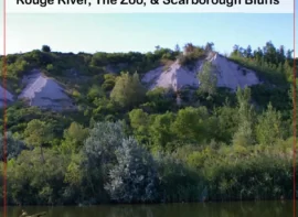
| 214.8 | Rouge Hill Park, Rouge River Bridge (both sides) (Toronto) | 91.1 |
| 215.8 | Exchange lanes: WB: thru to local ESTM. (Toronto) | 106.1 |
| 215.9 | Port Union Rd underpass | 105.8 |
| 216.1 | Exchange lanes: EB local to thru (Toronto) | 106.1 |
| 216.5 | WB Exit (from thru & local) for Port Union Rd, Highway 2 & 2A and Kingston Rd (Toronto) | 105.8 |
| 216.8 | EB Kingston Rd (Hwy 2) and 2A west and access to Port Union Rd Exit (Gas Station on Kingston Rd) ESTM. (Toronto) | 107.9 |
| 216.9 | Rouge Community Park | 113.7 |
| 217.2 | Exit 389 Meadowvale Rd half cloverleaf (Toronto) | 117 |
| 217.8 | Exchange lanes: WB: local to thru ESTM. (Toronto) | 120.1 |
| 218.3 | Exchange lanes: EB thru to local ESTM. (Toronto) | 120.1 |
| 219.6 | Conlins Rd underpass (no access) (Toronto) | 130.1 |
| 219.8 | Exchange lanes: WB: thru to local ESTM. (Toronto) | 140.8 |
| 220.1 | Exchange lanes: EB local to thru ESTM. (Toronto) | 139 |
| 220.2 | Exit 387 Morningside Ave half cloverleaf (Toronto) | 138.1 |
| 221.7 | Exit 385 Neilson Rd quarter cloverleaf (Toronto) | 152.1 |
| 221.9 | Exchange lanes: WB: local to thru (Toronto) | 150.9 |
| 222.2 | Exchange lanes: EB thru to local (Toronto) | 150.9 |
| 222.8 | Morningside Park S side (Toronto) | 150.9 |
| 223 | Centennial College-Progress Campus | 152.1 |
| 223.7 | Progress Ave underpass | 152.4 |
| 224 | Exit 383 Markham Rd half-cloverleaf (Toronto) | 155.1 |
| 224.6 | Exchange lanes: WB: local to thru (Toronto) | 162.2 |
| 225 | Exchange lanes: EB thru to local (Toronto) | 166.7 |
| 225.2 | McGowan Rd & Scarborough Town Centre Mall Exit #381 (Toronto) | 166.7 |
| 225.6 | Snowhill Park to N | 167 |
| 226.2 | McDairmid Woods Park to N (Toronto) | 167 |
| 226.6 | EB only Brimley Rd & Scarborough Town Centre Mall Exit #380 (Toronto) | 167 |
| 226.8 | Exchange lanes: EB thru to local (Toronto) | 167 |
| 227.2 | Exhchange Lanes: WB local to thru (Toronto) | 166.1 |
| 227.4 | Midland Ave underpass (no access) (Toronto) | 167 |
| 227.5 | Railway underpass | 167 |
| 227.7 | Exit 379 Kennedy Rd half-cloverleaf (Toronto) | 167 |
| 227.8 | Glamorgan Park to S (Toronto) | 167.9 |
| 228 | Railway underpass (Toronto) | 168.9 |
| 228.2 | Birchmont Rd underpass (no access) (Toronto) | 171 |
| 229 | Exchange lanes: WB local to thru, EB thru to local (Toronto) | 174 |
| 230 | Exit 378 Warden Park half-cloverleaf (Toronto) | 174 |
| 230.8 | Wishing Well Park to N (Toronto) | 168.9 |
| 231.1 | Exit 376 Victoria Park half cloverleaf (Toronto) | 168.9 |
| 231.6 | WB Exit 375 to Don Valley Parkway (Hwy 404) from both local and thru lanes (Toronto) | 168.9 |
| 231.8 | WB Exchange lanes: between thru & local, local & thru (Toronto) | 168.6 |
| 232.2 | EB Exit 375 to Don Valley Parkway (Hwy 404) from both local and thru lanes (Toronto) | 141.7 |
| 232.3 | Don Mills Rd underpass (no access) (Toronto) | 138.7 |
| 233 | Havenbrook park to N (Toronto) | 127.1 |
| 233.8 | Moatfield Farm Park to S (Toronto) | 135 |
| 233.9 | Exit 373 Leslie St underpass (Toronto) | 138.1 |
| 234.2 | railway underpass (Toronto) | 143.6 |
| 236 | Exchange lanes:EB thru to local, WB local to thru (Toronto) | 170.4 |
| 237 | Exit 371 Bayview Ave (Toronto) | 167.9 |
| 237.9 | Exit 369 to Highway 11 Yonge St (Toronto) | 142.6 |
| 238 | pass over Don Valley Golf Course (both sides) (Toronto) | 138.1 |
| 239 | Exchange lanes: from local to thru lanes (Toronto) | 155.1 |
| 240 | Exit 367 Avenue Rd interchange (Toronto) | 167.6 |
| 241 | Wilson Ave underpass (no access) (Toronto) | 181.7 |
| 241.3 | WB exit 366 Bathurst St underpass, gas (Toronto) | 182 |
| 242 | Exit 365 Allen Expressway interchange (Toronto) | 181.7 |
| 244 | Dufferin St underpass Exit 364 to Yorkdale Shopping Centre (Toronto) | 182 |
| 245 | Exit 362 Keele St underpass (Toronto) | 171.6 |
| Grand Prix Kartways, indoor go-kart track |
| 245 | Railway underpass (Toronto) | 182 |
| 246 | EB Exchange lanes: between thru & local lanes (Toronto) | 127.4 |
| 246 | WB Exchange lanes: between thru & local lanes (Toronto) | 146.6 |
| 247 | Jane St underpass (no access) (Toronto) | 126.2 |
| 248 | 400& 401 Interchange (401 Exit 359) (Toronto) | 130.1 |
| KM | Highway Point & Features | Elev.
(metres) |


 Route Overview
 The meandering Highway 2, which goes through many small towns on the north shore of Lake Ontario and along the Saint Lawrence, was supplanted by the high volume 401 (the “Macdonald Cartier Freeway”, and between

 The
The ")