Trans-Canada Highway.com please wait to load
What
image
  • imageAccommodations
  • imageAir Travel
  • imageAirport Parking
  • imageAttractions
  • imageAutomotive
  • imageBed & Breakfasts
  • imageBoat Rentals or Charters
  • imageBuses or Shuttles
  • imageCafe
  • imageCampgrounds
  • imageCasinos
  • imageCinema
  • imageCraft Beer - Winery
  • imageCurrency Exchange
  • imageEmergency
  • imageEntertainment
  • imageFarmers Market
  • imageFestivals
  • imageFire Hall
  • imageFirst Nation
  • imageFlea market
  • imageFree
  • imageGolf Course
  • imageGovernment
  • imageHistorical
  • imageHospital
  • imageHostel
  • imageHotels
  • imageKids Amusement
  • imageLimousines
  • imageLong Term Rental
  • imageMarijuana /CBD
  • imageMarinas
  • imageMuseum / Gallery
  • imagePark
  • imagePolice
  • imagePublic Transit
  • imageRental Car
  • imageRest Stops
  • imageRestaurant
  • imageRV Rental
  • imageShopping
  • imageShopping District
  • imageShopping mall
  • imageSki Resort
  • imageSpa
  • imageSports & Recreation
  • imageSports Team
  • imageTaxi
  • imageTheatre
  • imageTour
  • imageTourist Services
  • imageTours & Tour Guides
  • imageTrain
  • imageTransit Hub
  • imageTransportation
  • imageTravel
  • imageTravel Info/Office
  • imageVacation Rental
  • imageWilderness Lodge
Where
image
image

Highway Itineraries & Segments

Want to Plan your Cross-Canada Road Trip?

Here are all the things to see and do on your road trip, coast-to-coast, or a shorter stretch… Pick your starting point (or western-most point) and  your end-point (or eastern-most point) and click on each segment for the details, description, elevation chart, and map. The table below shows length of the segment to plan driving time, breaks, meals, and overnight stops. and you can always refer back to our Large scale route map.

Learn about / plan the towns and cities along each segment. Find out about Canada’s exciting history..

TCH Itineraries-Trip planning details
Animal Bridges along the Trans-Canada Highway in Banff National Park

Animal Bridges along the Trans-Canada Highway in Banff National Park

How many segments can you drive in a day?

Depending on how long you want to drive each day, which can be influenced, how much site-seeing you are doing, if you are driving with kids, or the weather and quality of driving conditions, or the hours of sunlight at different times of the year.

For example, driving across the Prairies, you can drive further (and see more) in summer driving with 12-14 hours of daylight, than in winters driving with just 6 hours of daylight. And in the winter, also allow for slower driving during poor visibility during snowstorms, or when required to stop for mountain avalanche control  (watch our TCH News page or our Facebook page for weather bulletins). Of course, in summer there are often delays or detours because of construction.

The itineraries listed here are from 150 km to 250 km (taking approximately 2 hours of driving time).

You can choose 1-4 segments per driving day to suit your preferred pace. The itineraries are designed like bus schedules, with both eastbound and westbound distances on the same page,
so you only need one set to the trip there and back.

Each Trans-Canada Highway Itinerary Segment Details

Here’s what sets TransCanadaHighway.com apart from all the others. Here are key features of our itineraries (see list below):

  • Details on over 3500 points along the highway
  • Segment overviews: what not to miss, what’s interesting re. history, geology and nature. Especially between towns….
  • Clickable links to town and city pages for even more detailed info, history, and attractions for that town.
  • Overview Zoom-able Google map for each segment
  • Elevation chart for each segment, for cycle-touring across Canada.
  • Tabular listing of all highways, rivers, lakes, streets, roads, and attractions you pass on your drive for useful and interesting information.

NOTE

Provincial overviews of the Yellowhead Highway travel east to west, but the Itinerary descriptions and details go from west to east

View of Trans-Canada #1 approach to Rockies from Calgary

Trans-Canada Highway Routes in Canada

Here are some other top drives in Canada, and those marked with 🍁 are considered part of the official  Trans-Canada Highway network. You can view the itineraries here by ROUTE. or alternatively by PROVINCE (or using the Provinces menu)

Trans-Canada Highway Main Route (mostly) #1 #17

Main Trans-Canada Highway 🍁

This route is the main route (Route #1 | 17 | 20 | 85 | 2 | 104 | 105 | 1) across Canada and crosses all provinces from Victoria BC to St John’s Newfoundland and is 7,821 long.

Yellowhead Route #16

Yellowhead Highway #16 (MB | SK| AB | BC) 🍁 located on the Yellowhead Highway

This route is considered the northern route in  Western Canada, and covers BC and the Prairie provinces, and runs for 1,990 kilometres.

Travel the Crowsnest Highway #3

Crowsnest Highway #3 (BC | AB) 🍁 located on the Crowsnest Highway

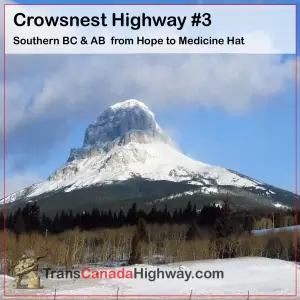
This route is considered the southern route in Alberta and BC, connecting Hope BC and Medicine Hat AB, and travels very close to the Canada- US border. It runs for 1,186 kilometres.

Ontaro Northern Route #11

Northern Route QU #117 | ON #11 🍁located on the Ontario Northern Route

This route is both the northern route in Ontario connecting North Bay, Nipigon, Thunder Bay and Fort Frances, and includes a great route for getting from Toronto and Barrie up to Ontario’s cottage country (Georgian Bay, Muskokas, and Algonquin Park). The Norhtern Route runs for 2,664 kilometres.

Trans-Canada Southern Ontario Route

Southern Route ON #7 |  #12 | #400 🍁located on Ontario Southern Route

This is the southern (and very scenic) route through Ontario from Ottawa to Peterborough (never quite touching Toronto) and then heading north toward Parry Sound and Sudbury. This route runs 679 kilometres.

Ontario 401- WIndsor-Toronto-Montreal

Highway 401 Windsor to Toronto to Montreal

This route is also called the Macdonald-Cartier Freeway and connects Ontario’s major industrial and population centres, and runs for 828 kilometres.

See also the To-From Toronto  Route using the 401 and the 400/69 Highways.

Alaska Highway- BC NWT and Yukon

Alaska Highway AB #43, BC #97, YU #1

This is the best route from Alberta and BC to reach the Northwest Territories and the Yukon, before crossing into Alaska and runs for 2,787 kilometres.

Arctic Highway-Dempster and Inuvik-to-Tuk

Arctic Highway (Edmonton – Tuktoyaktuk)
Including Dempster Highway and Inuvik-to-Tuk Highway

This is the best route to reach Mackenzie River and the Arctic Ocean in Canada’s North, and runs for 2,433 kilometres

Trans-Labrador Highway, Quebec City to Labrador to Newfoundland

Trans-Labrador Highway Route
Quebec City to Labrador City to Happy Valley / Goose Bay to Deer Lake

This route starting in the St Lawrence near Quebec City and traverses Labrador before hitting the coast and letting you take a short ferry ride to the northern portion of Newfoundland, and runs for a total of 2433 kilometres.

Some Frequently Asked Questions about the Trans-Canada Highway:

Where does Trans-Canada Highway start and end?

The highway extends west-east between the Pacific and Atlantic coasts across the breadth of Canada  for 7,821 km (4,860 miles), between Victoria (on Vancouver Island in  British Columbia) and St. John’s ( in Newfoundland and Labrador). See full details of the itinerary on this Itineraries page.

How long does it take to drive the Trans-Canada Highway?

This route covers 7,821 km (4,860 miles) and would take at least 100 hours of pure driving time, including stops for refilling your gasoline, but not including ferries and ferry wait times. (In the west, you might have a 1 or 2 hour ferry ride to Vancouver Island and and up to 3 hour wait, and in the Maritimes, you might have a 5 to 10 hour ferry ride to Newfoundland with an up to 12 hour wait). If you add overnight stops and do some sightseeing,  and drive an average of 400 km (250 miles) on per day, a well-planned drive across Canada will take about 3 weeks, each direction.

Is the 401 part of the Trans-Canada Highway?

Highway 401 extends for 828 kilometres (514 mi) from Windsor (connecting to Detroit, Michigan) in the west to the Ontario–Quebec border in the east (connecting to Montreal, Quebec) and runs through Toronto, Ontario.  The 401 is also known as the Macdonald-Cartier Freeway, but is NOT PART of the Trans-Canada Highway.  The TransCanadaHighway.com web site features a “detour” from the TransCanada Main Route to Toronto.
The Southern Route through Ontario extends from Ottawa via Highway 7 west to Peterborough, northwest via Highway 11 through Orillia, and then north on Highway 400 though Parry Sound to Sudbury. This southern route at Peterborough is 100 km from Toronto’s municipal boundary and 140 km from its downtown center.